Turn your Phone into a Flight Radar displaying real-time
flights around the world.
Size : 8.6M
Updated : April 14, 2014
Requires Android : 4.0 and up
More information :
https://play.google.com/store/apps/details?id=com.airnav.android.pro
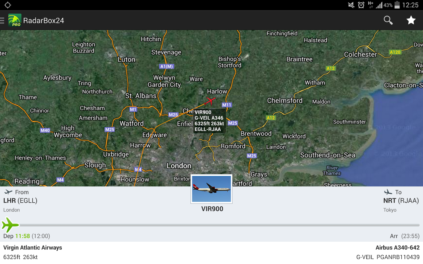
SCREENSHOT :
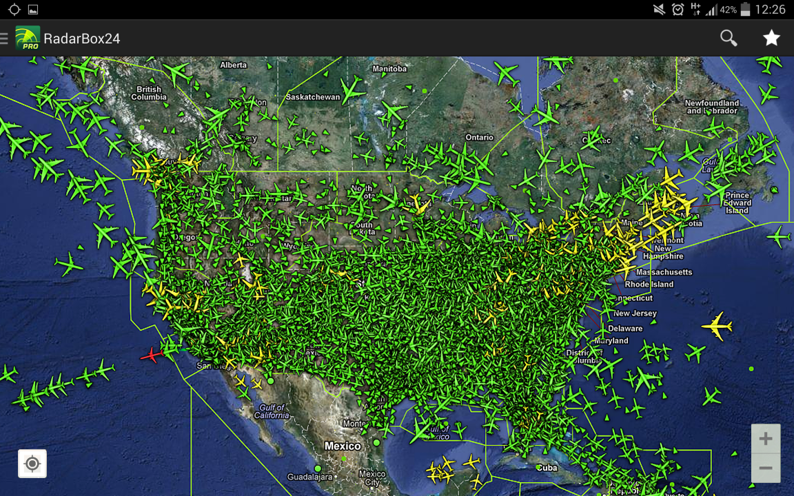
RadarBox24 has been developed by Aviation Professionals including Airline Pilots.Data
comes in real-time from the Aircraft Transponder to your phone using a
network of thousands of AirNav RadarBox ADS-B receivers deployed in over
100 countries.
Why RadarBox24:
- Real-time fligfht data directly from the aircraft transponder to your phone
- Designed by Professional Airline Pilots
- SkyView: point your phone to the sky to identify a flight
- Continuous network growth thanks to new RadarBox receivers being deployed daily all over the world
- Full search functionality: search for a flight, city or airport
- Position estimates over remote oceanic areas
- Possibility of saving your favorite locations
- Aircraft photos
- Real-time departure/arrival ticker
- Nearby flights
- Detailed data source information
How does RadarBox24 work?
Every RadarBox receiver is designed to share real-time flight data to AirNav Systems servers. Data comes from thousands receivers located all over the world and is processed on AirNav Systems central servers at an amazing rate of over 20 million messages per day. This data is then used in several aviation solutions (airlines, airports and airspace companies), but also aviation enthusiasts. RadarBox24 allows you to access this data in web browsers and mobile solutions.
Coverage:
Data comes in real-time from RadarBox and other mode-s receivers from all over the world.
US data data comes not only from ADS-B receivers but also from a direct link to FAA radar stations.
90% of Europe is covered in addition to hundreds of locations in other continents.
What's New
- Fix for users who disabled location service on their devices.
- Will post tooltip message when unable to access location service.